-
Google Street View: Hyperlapse tutorial
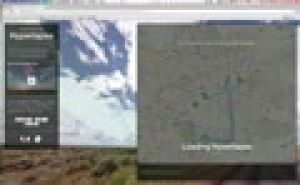
The Street View feature in Google Maps is a handy tool, including useful in teaching geography. But you still can use this panoramic photos much more proves the design Teehan + Lax (Toronto). They made Street View imagined n hyperlapses …
Translated by
 VideoTeacher
 -
Teachem: Make YouTube videos interactive

TEACHEM is a free web tool that lets you search YouTube videos can convert online lessons can be private or public. A variety of additional teaching and learning resources, such as Flash cards and SmartNotes make it a unique and powerful tool for …
Translated by
VideoTeacher -
Pilot Study bottoms: Sand, silt, clay

A detailed practicum in which students in an experimental way the features detecting soil fractions: sand, silt, clay.
They investigate include:
- water permeability,
- grain size composition,
- cohesion.
Translated by
Downloadable resource (13)Student (teacher training) -
Weather instruments

A lesson plan for students to carry out meteorological measurements. They started with a thermometer, hygrometer, anemo-, baro and rain gauge.
In addition to the execution of the measurements, there is also an evaluation, which is plumbed to the …
Translated by
Downloadable resource (5)Student (teacher training) -
Didactic added value of Geocaching: Thesis

Geocaching, a global treasure hunt with GPS devices, is also popular in Belgium in the wake of rising smartphone sales. In nature you will search for a hidden treasure or (geo) cache. This treasure contains goodies or trading items such as toys, key …
Translated by
Downloadable resource (23)Organisation, company, NPO
Yummmm… cookies!
We don't like being tracked either. That's why we're concerned about your privacy.
Necessary cookies: for the proper operation of the website.
Functional cookies: for your convenience. recommended
Social media cookies: to view embedded media such as videos from YouTube, Facebook … recommended
Statistical cookies: for anonymous data collection to enhance user experience.