-
Controlling Micro:bit with MicroBlocks

Short video on how to use MicroBlocks.fun for the first time to program the micro:bit. You will see, among other things, how to:
- adapt the language;
- controls the LEDs to program a smiley, for example;
- programs the game of sheet-rock-paper on the …
Translated by
 VideoTeacher, ICT co-ordinator
 -
Cleaning up shipwrecks: Infographic

Last year, a team of professional divers removed 8 tons of fishing nets, fishing weights and other marine litter from the sunken shipwreck SS Kilmore.
Inform your students about this problem with the help of this informative search plate.Translated by
Image -
First aid for dental accidents: Info sheet

This information sheet was drawn up by the Flemish Institute for Oral Health and indicates what to do in the event of a broken or displaced (milk) tooth.
Translated by
Image
-
Bitcoin: Briefly explained

Informative video about Bitcoin. The video can be used in the first years of secondary education. The video is very simple, the explanation is also basic.
Questions you can ask about the video:
- What is Bitcoin?
- How is bitcoin controlled?
- What is the …
Translated by
VideoTeacher -
Beverage and food: Water footprint price lists

These price lists show you how much water it costs to make certain drinks and meals. Nice to use to raise awareness about the water footprint at school parties, receptions ...
Translated by
Image (5)
-
Water Footprint: Infographics

In a few images we provide information about the water footprint in general, the water footprint of clothing, paper, food, snacks and drinks and some tips to reduce your water footprint.
Translated by
Image (20)
-
Let the sea level rise in Google Earth

On the basis of this instruction you can a teacher make the sea level rise in Google Earth.
Translated by
VideoTeacher, Other -
Using Odyssey.js: Explanation Video

Odyssey.js is a free tool to add text, integrate photos and interactive maps together to create a digital story.
This video explains how you can create a story Odyssey.js. Students can place on a map and write a text about it. There is also the …
Translated by
VideoTeacher -
Step by step to build a timer Kodu: Tutorial

If you have this movie that leads you around the basic functions of Kodu Game Lab been eyeing, then this short guide is a good addition. See step by step how to program the game a 'timer': it is a tree of sixty counts down to zero then …
Translated by
VideoSchool/education -
Google Street View: Hyperlapse tutorial
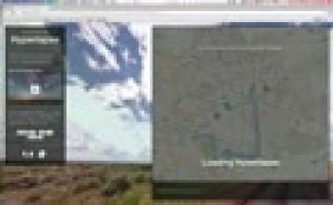
The Street View feature in Google Maps is a handy tool, including useful in teaching geography. But you still can use this panoramic photos much more proves the design Teehan + Lax (Toronto). They made Street View imagined n hyperlapses …
Translated by
VideoTeacher -
Roofs and facades of houses: Wall panels

These wall charts are made to go out with the students and discuss houses.
Translated by
Image (4)Student (teacher training) -
Klimatogram

This tutorial explains about klimatogrammen both theory and exercises.
Translated by
Video (12)Schoolboard, ICT co-ordinator
Yummmm… cookies!
We don't like being tracked either. That's why we're concerned about your privacy.
Necessary cookies: for the proper operation of the website.
Functional cookies: for your convenience. recommended
Social media cookies: to view embedded media such as videos from YouTube, Facebook … recommended
Statistical cookies: for anonymous data collection to enhance user experience.