-
PlayZone Europe: Temporary exhibition

Belgium will become President of the Council of the European Union in the spring of 2024. Mechelen is organizing a major cultural and social festival Construct Europe to put this presidency in the spotlight.
As part of this city festival, the …Translated by

till
Training or activity
-
Open card. Region under the microscope: Project

The project encourages residents, visitors, volunteers, etc. to discover, investigate and map the wide area around De Helix. Since 2015, De Helix has been organizing a whole series of activities with many different people and groups, of all ages. …
Translated by
Training or activity
-
GUM for teachers: Educational offer

Schools can go to the GUM for interactive tours and workshops about scientific thinking and the way you do science. The GUM challenges a critical view and stimulates scientific literacy. What exactly does a scientist do? Is a researcher allowed to …
Translated by
till
Training or activity
-
Educational Product: Nature & Culture Installation

On the basis of the Nature & Culture Installation, the children learn in an interactive way about nature and sustainability. There are 4 themes, each theme starting from a visual artwork that will trigger the visitors to further explore the …
Translated by
till
Training or activity
-
Let the sea level rise in Google Earth

On the basis of this instruction you can a teacher make the sea level rise in Google Earth.
Translated by
VideoTeacher, Other -
Kei-Cool: An exhibition about rocks and minerals

Can rocks melt? And how do tectonic plates shift?
You will learn this and much more in this permanent exhibition in The World of Kina:
- take the elevator to the core of the earth and discover how the earth is constructed;
- plate tectonics, …
Translated by
till
Training or activity (3)
-
Using Odyssey.js: Explanation Video

Odyssey.js is a free tool to add text, integrate photos and interactive maps together to create a digital story.
This video explains how you can create a story Odyssey.js. Students can place on a map and write a text about it. There is also the …
Translated by
VideoTeacher -
Relief: Flipping the classroom

This video explains in six minutes from the significance of relief and how it is displayed on the map. There is greater emphasis on:
- slope;
- contour;
- contour interval;
- altitude and altitude rate;
- altitude zone;
- legend.
Translated by
Video (17)Teacher -
Google Street View: Hyperlapse tutorial
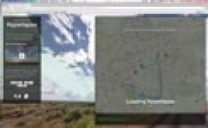
The Street View feature in Google Maps is a handy tool, including useful in teaching geography. But you still can use this panoramic photos much more proves the design Teehan + Lax (Toronto). They made Street View imagined n hyperlapses …
Translated by
VideoTeacher -
Teachem: Make YouTube videos interactive

TEACHEM is a free web tool that lets you search YouTube videos can convert online lessons can be private or public. A variety of additional teaching and learning resources, such as Flash cards and SmartNotes make it a unique and powerful tool for …
Translated by
VideoTeacher -
Wase Polder: Poster exhibition

For the apotheosis of the polder project, the Erfgoedcel Waasland developed a series of posters that tell the story of the Wase polders and waterways in words and images. The exhibition consists of nine posters in A2 format, each of which …
Translated by
Tangible material
-
Visually compare the surface of countries

Sometimes it's hard to explain how small Belgium is facing a country like Australia. The website If It Were my home there is a response.
This screencast you get to know the potential of this site.
You can not only compare the size of two …
Translated by
VideoTeacher
Yummmm… cookies!
We don't like being tracked either. That's why we're concerned about your privacy.
Necessary cookies: for the proper operation of the website.
Functional cookies: for your convenience. recommended
Social media cookies: to view embedded media such as videos from YouTube, Facebook … recommended
Statistical cookies: for anonymous data collection to enhance user experience.